| Picture comment | | Picture (thumbnail) |
Picture 06-5-175
Time to go. |   | 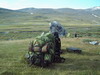 |
Picture 06-5-176
The back packs are ready. | | 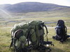 |
Picture 06-5-177
The sun was rather strong yesterday. | |  |
Picture 06-5-178
Nice edges. | |  |
Picture 06-5-179
Just outside Glitterheim. | | 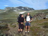 |
Picture 06-5-180
New bridge, new pictures. | | 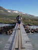 |
Picture 06-5-181
dirty glacier water. | | 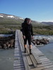 |
Picture 06-5-182
Veo with Glitterheim and Glittertind in the background. | | 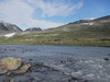 |
Picture 06-5-183
Glittertind. | | 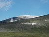 |
Picture 06-5-184
Veobreen. | | 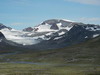 |
Picture 06-5-185
This is the way...up. | | 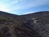 |
Picture 06-5-186
Hansson excelent tripod. | | 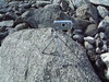 |
Picture 06-5-187
A group picture at the crest. | |  |
Picture 06-5-188
Not far down to Russvatnet. | | 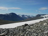 |
Picture 06-5-189
Chocolate and peeing time. | | 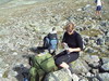 |
Picture 06-5-190
Russvatnet far away. | | 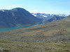 |
Picture 06-5-191
The passage of a rocking bridge at Blåsjönnåe. | | 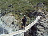 |
Picture 06-5-192
You had to hold tight. | | 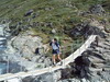 |
Picture 06-5-193
The lake lies like a mirror. | | 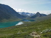 |
Picture 06-5-194
Russvatnet towards east. | | 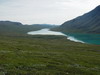 |
Picture 06-5-195
Nautgardstind. | | 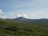 |
Picture 06-5-196
A short break in the shadow. | | 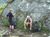 |
Picture 06-5-197
The path went along the lake. | | 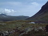 |
Picture 06-5-198
Blackwellbue. | | 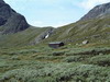 |
Picture 06-5-199
Cristal clear water. | | 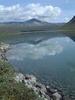 |
Picture 06-5-200
A bird tries to hide in the terrain. | | 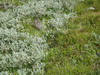 |
Picture 06-5-201
A last picture of Russvatnet. | | 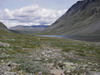 |
Picture 06-5-202
The last uphill slope. | | 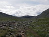 |
Picture 06-5-203
Nice mountain formations. | | 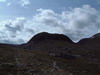 |
Picture 06-5-204
The creeks was dried out. | | 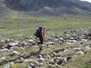 |
Picture 06-5-205
Berra checks the surroundings. | | 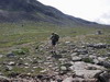 |
Picture 06-5-206
Besshöe. | | 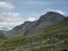 |
Picture 06-5-207
Nice terrain. | | 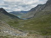 |
Picture 06-5-208
Stoney in the uphill slope. | | 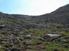 |
Picture 06-5-209
Finally at the route crossing towards Besseggen/Memurubu. | | 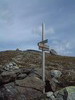 |
Picture 06-5-210
The route to Bukkelägret follows the ridge. | | 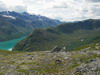 |
Picture 06-5-211
gravel in the downhill slope. | | 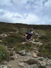 |
Picture 06-5-212
A lot of people in front of us. | | 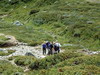 |
Picture 06-5-213
Memurubu from above. | | 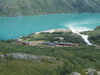 |
Picture 06-5-214
Surtningssui. | | 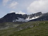 |
Picture 06-5-215
The stream Murus outlet in the lake Gjende. | | 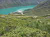 |
Picture 06-5-216
Just a litle slope left. | | 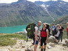 |
Picture 06-5-217
The terrace at Memurubu. | | 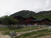 |
Picture 06-5-218
The lake Gjende. | | 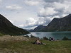 |
Picture 06-5-219
We are waiting for the ferry. | | 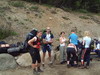 |
Picture 06-5-220
Back at the camping Maurvangen. | |  |
Picture 06-5-221
Time to refill the logo again. | |  |