| Picture comment | | Picture (thumbnail) |
Picture 06-1-1
Annika looks forward to one week of hiking. |   | 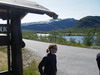 |
Picture 06-1-2
View of lake Gjende. | | 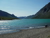 |
Picture 06-1-3
On our way to Gjendesheim. | | 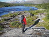 |
Picture 06-1-4
A short break in the sun outside the tourist hut. | | 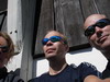 |
Picture 06-1-5
The ferry berth at Gjendesheim. | | 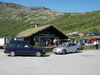 |
Picture 06-1-6
We are waiting for our turn to walk aboard. | | 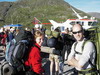 |
Picture 06-1-7
A fishermen trying to catch some trouts. | | 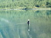 |
Picture 06-1-8
On the ferry. | | 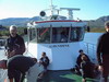 |
Picture 06-1-9
A short walk from the harbour to Gjendebu. | | 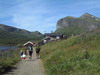 |
Picture 06-1-10
Of course the Norwegian flag was hoisted. | | 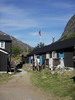 |
Picture 06-1-11
A lot of activities outside the hut. | | 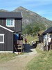 |
Picture 06-1-12
Packed and ready for a hard walk. | | 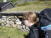 |
Picture 06-1-13
A short glance back before leaving Gjendebu. | | 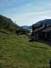 |
Picture 06-1-14
Gjendealperne. | | 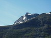 |
Picture 06-1-15
A short pause in the warmth. | | 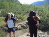 |
Picture 06-1-16
Storåe. | | 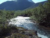 |
Picture 06-1-17
The path went along the stream. | | 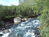 |
Picture 06-1-18
The beginning went on fine paths inside the birch forrest. | | 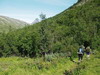 |
Picture 06-1-19
A bird was singing on the rock. | | 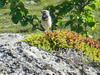 |
Picture 06-1-20
Storå valley south. | | 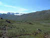 |
Picture 06-1-21
The first man-made mound of stones. | | 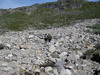 |
Picture 06-1-22
The first bridge. | | 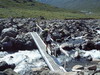 |
Picture 06-1-23
No signs of fatigue jet. | | 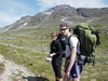 |
Picture 06-1-24
Time for some food. | | 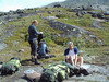 |
Picture 06-1-25
Here the stream Storån started. | | 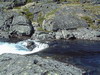 |
Picture 06-1-26
A glance back to our resting place at the other side of the lake. | | 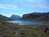 |
Picture 06-1-27
The trail followed the lake. | | 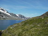 |
Picture 06-1-28
Gjendealperna in the background. | | 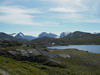 |
Picture 06-1-29
Wonderful views. | | 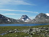 |
Picture 06-1-30
The route cross towards Spiterstulen. | | 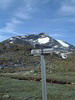 |
Picture 06-1-31
The route cross towards Olavsbu. | | 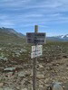 |
Picture 06-1-32
A short break in the sun. | | 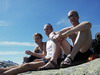 |
Picture 06-1-33
The route towards Olavsbu went over the ridge. | | 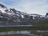 |
Picture 06-1-34
On our way towards Leirwassbu. | | 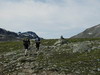 |
Picture 06-1-35
fine paths to follow. | | 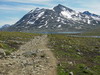 |
Picture 06-1-36
Högvagltjönnen. | | 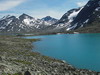 |
Picture 06-1-37
Stoney but still fine paths. | | 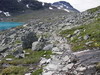 |
Picture 06-1-38
Högvagelbreen. | | 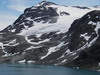 |
Picture 06-1-39
Gravdalstjörnene. | | 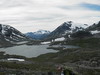 |
Picture 06-1-40
Finally at Leirvassbu. | | 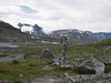 |
Picture 06-1-41
We had been here before. | | 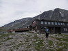 |
Picture 06-1-42
Kyrkja. | | 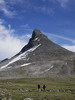 |
Picture 06-1-43
Our tent place at the foot of Kyrkja. | | 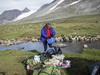 |
Picture 06-1-44
Cooking time. Gulash on the menu. | | 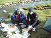 |
Picture 06-1-45
Perfect tent place with water nearby. | | 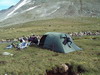 |