| Picture comment | | Picture (thumbnail) |
Picture 98-9-119
Olavsbu. |   | 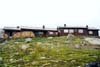 |
Picture 98-9-120
Stony as you can see. Not many tent places here. But there were two near the cottage. | | 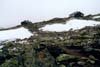 |
Picture 98-9-121
Clean and dry shoes isn’t wrong. They were in the same shape after the hike to Gjendebu. | | 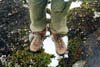 |
Picture 98-9-122
Sometimes it’s damn stoney. | | 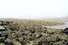 |
Picture 98-9-123
And sometimes like a highway. You could also camp here if you wanted. | | 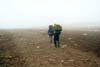 |
Picture 98-9-124
Raudalen towards Gjendebu. | | 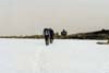 |
Picture 98-9-125
Vessledalen far away. | | 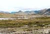 |
Picture 98-9-126
Besshø in the background. | | 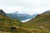 |
Picture 98-9-127
Gjende and Besseggen far away. | | 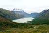 |
Picture 98-9-128
Gjendebu. | | 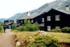 |
Picture 98-9-129
The ferry to the civilization. | | 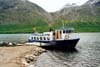 |
Picture 98-9-130
Gjendestunga in the background. | | 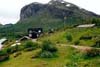 |
Picture 98-9-131
The famous Bukkelægret. It has to wait for the next hike in Jotunheimen. | | 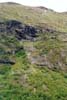 |
Picture 98-9-132
Besseggen. | | 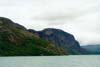 |
Picture 98-9-133
Memurubu. | | 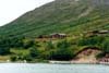 |
Picture 98-9-134
Besseggen again. If you have not tested this route, test it! You won’t be disappointed. | | 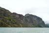 |
Picture 98-9-135
Gjendesheim. | | 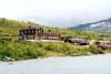 |