| Picture comment | | Picture (thumbnail) |
Picture 98-6-56
Skogadalsbøen. |   | 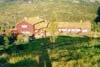 |
Picture 98-6-57
Gertvassdalen on the way up to Fannaråken. | | 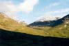 |
Picture 98-6-58
North of Utladalen. | | 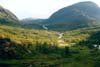 |
Picture 98-6-59
Gjertvassbreen. | | 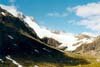 |
Picture 98-6-60
Fannaråken far not far away. But still you have to use a hour or two. | | 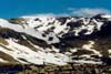 |
Picture 98-6-61
Illvatnet. | | 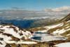 |
Picture 98-6-62
Picture towards Keisarpasset. | | 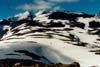 |
Picture 98-6-63
A short break before the hike towards Fannaråken. | | 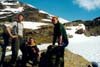 |
Picture 98-6-64
Fanaråkfossen in the middle of the glacier. | | 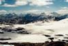 |
Picture 98-6-65
Smørstabbreen. | | 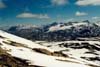 |
Picture 98-6-66
The steep towards Fannaråken. Nice ski weather. | | 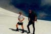 |
Picture 98-6-67
The old weather station. | | 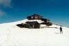 |
Picture 98-6-68
The new cottage at Fannaråken. | | 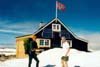 |
Picture 98-6-69
Fannaråken cottage at sun shine. The Norwegian flag is moving nicely against the blue sky. | | 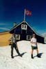 |
Picture 98-6-70
Hurrungane in the background. | | 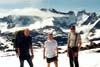 |
Picture 98-6-71
The pictures was taken by one of the employers at the cottage. She was quite successful. | | 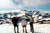 |
Picture 98-6-72
Inside the cottage. This was the last picture of Magnus shirt. As far as we know it’s still there. | | 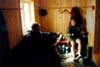 |
Picture 98-6-73
The weather station is carefully secured in the mountain. | | 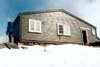 |
Picture 98-6-74
The view towards Eidsvatnet, Skjolden. | | 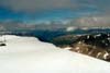 |
Picture 98-6-75
Picture taken from the weather station. | | 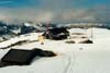 |
Picture 98-6-76
Smørstabbreen. | | 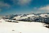 |
Picture 98-6-77
The view east. | | 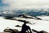 |
Picture 98-6-78
The view towards Skogadalsbøen. | | 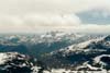 |
Picture 98-6-79
The view north. | | 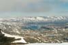 |
Picture 98-6-80
Eidsvatnet far away in the background. | |  |
Picture 98-6-81
Hurrungane. | | 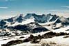 |
Picture 98-6-82
Kite practice is going on. It didn’t went so well. | | 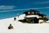 |
Picture 98-6-83
Hurrungane once again. | | 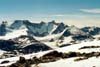 |
Picture 98-6-84
Blue sky or what? | |  |
Picture 98-6-85
Classic picture. | | 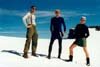 |
Picture 98-6-86
Magnus is leading the way. | | 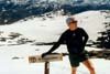 |
Picture 98-6-87
Very blue sky. | | 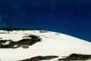 |
Picture 98-6-88
Our camp at Skogadalsbøen can be seen once again. | | 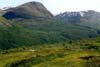 |