| Picture comment | | Picture (thumbnail) |
Picture 03-3-63
The large cliff stone at the beginning of the hike. |  | 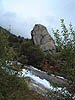 |
Picture 03-3-64
Double signs. | | 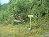 |
Picture 03-3-65
Resting place with nice overview of Sörfjorden. | | 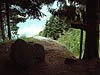 |
Picture 03-3-66
A short break at Röynhogg. | | 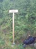 |
Picture 03-3-67
Rain on it's way? | | 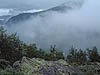 |
Picture 03-3-68
Chocolate break. But where is the chocolate? | | 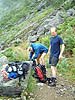 |
Picture 03-3-69
We found two wind shelters on our way up. Of course with guest books. | | 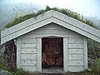 |
Picture 03-3-70
The path was sometimes like smaller roads. | | 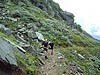 |
Picture 03-3-71
Hansson writes in the guest book. | | 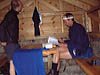 |
Picture 03-3-72
Berra eats crisp bread. | | 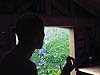 |
Picture 03-3-73
Storenutstjörn. | | 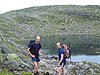 |
Picture 03-3-74
Large sticks showed the way. | | 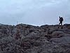 |
Picture 03-3-75
Holmaskjer far away. | | 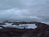 |
Picture 03-3-76
At the edge of the glacier. | | 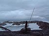 |
Picture 03-3-77
Isvatnet. | | 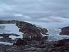 |
Picture 03-3-78
Well polished cliff formations at the glacier. | | 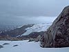 |
Picture 03-3-79
The blue ice was early this year. | | 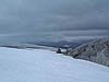 |
Picture 03-3-80
Magge at the front as always. | | 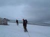 |
Picture 03-3-81
It was flat and little cracks on the glacier. | | 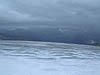 |
Picture 03-3-82
Now we are close to Holmaskjer. | | 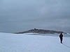 |
Picture 03-3-83
The view towards north. | | 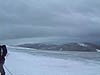 |
Picture 03-3-84
Finally! The cottage was larger than we thought. | | 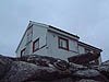 |
Picture 03-3-85
1565 meters above sea level which means that we have climbed almost 1500 meters. | | 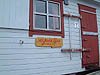 |
Picture 03-3-86
At Holmaskjer. | | 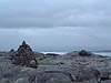 |
Picture 03-3-87
A glance back. | | 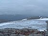 |
Picture 03-3-88
Far away you will find Fonnabu. | | 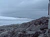 |
Picture 03-3-89
A picture towards the highest point of Folgefonna. | |  |
Picture 03-3-90
Berra on his way out from Holmaskjer. | | 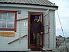 |
Picture 03-3-91
There were blue ice everywhere. | | 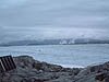 |
Picture 03-3-92
A last picture before the hike back. | | 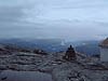 |
Picture 03-3-93
Hansson is well secured. | | 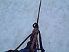 |
Picture 03-3-94
Another glacier picture. | | 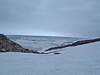 |
Picture 03-3-95
You had to pass the glacier to reach the other side. | | 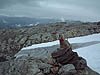 |
Picture 03-3-96
Back at Isvatnet. | | 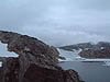 |